History of Carlow Castle
Carlow Castle guarded a crossing of the River Barrow for several centuries. Most of what you see today is the work of the early 13th century, and most of what is missing was lost in a single day in 1814.
Timeline
- Early 1180s: a timber castleArchaeology and a re-reading of the written sources suggest that the first castle here was a timber and earth fortification. It was built by Hugh de Lacy for John de Clahull, who held Carlow at the time.
- About 1207 to 1213: the stone keepWilliam Marshal, Earl of Pembroke and Lord of Leinster, is credited with building the stone keep, a rectangular tower with a round tower at each corner. The date is usually given as 1207 to 1213, although an archaeological report describes the work as beginning around 1210.
- Later centuries: a contested fortressThe castle passed through many hands and was fought over repeatedly. It became Crown property in 1306 and was held by the Earls of Norfolk until 1537, and the Earl of Thomond acquired it in 1616.
- 1650: Cromwell's armyCromwell's forces reached Carlow in July 1650, during the Cromwellian conquest of Ireland.
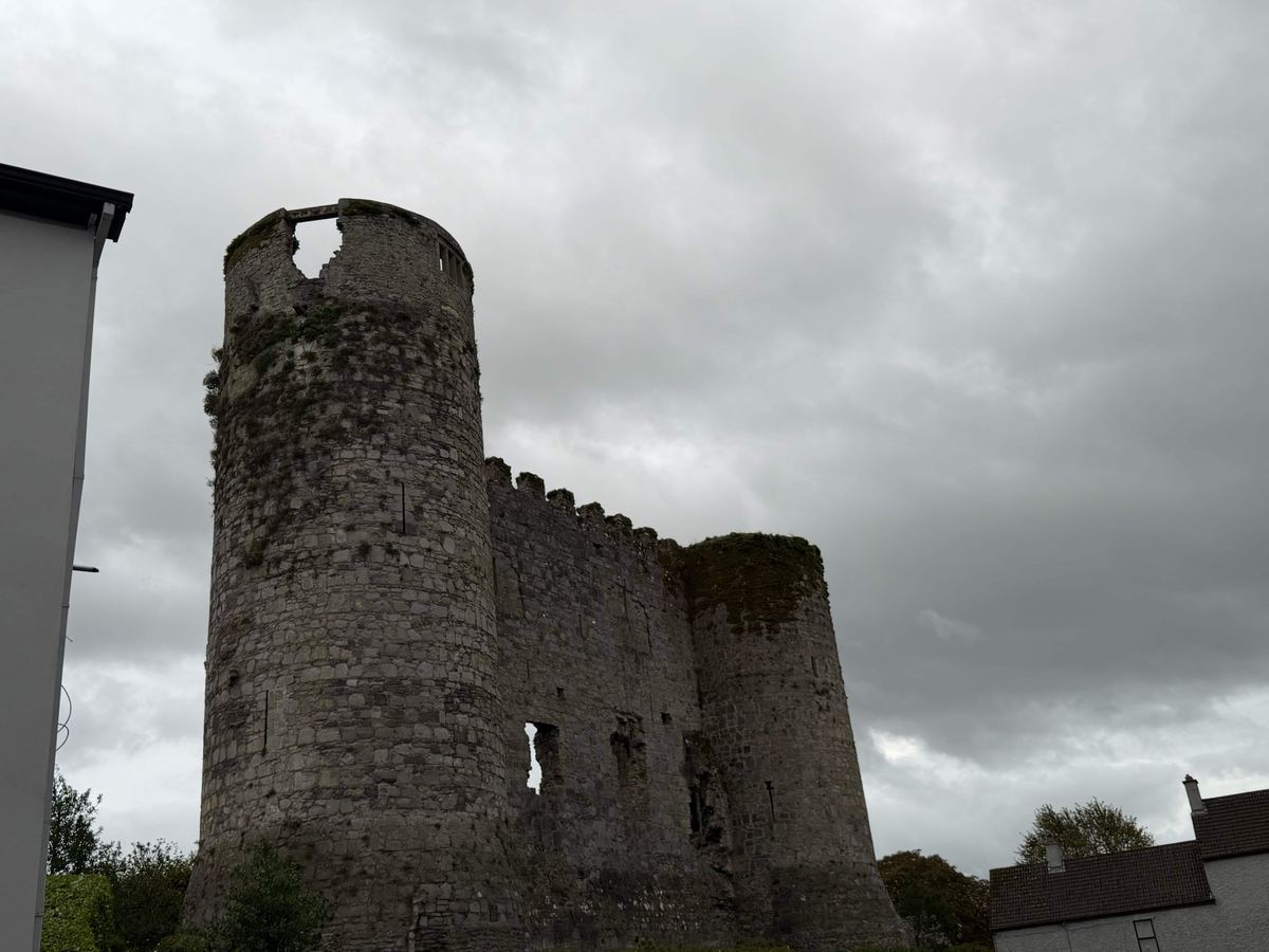
- 1814: the explosionAn attempt to convert the castle into an asylum went badly wrong, and an explosion during the work brought down much of the structure. Only the west wall and two towers survived.
- TodayThe ruin is a National Monument, free to view and part of Carlow's town-centre riverside.
Who built it?
Older local histories often credit Hugh de Lacy with the whole castle. Modern archaeology paints a more detailed picture: de Lacy's timber fortification came first, and the stone keep followed a generation later under William Marshal. You will see both names in guidebooks, and both have a claim.
Why here?
The castle stands on a rise beside the River Barrow, near where the Burrin joins it. The Normans wanted to control the river crossing and the route through the Barrow valley. Archaeologists have also linked the keep to Marshal's plan to build a market town that would trade down the Barrow towards New Ross.
The ruin today
The surviving west wall shows the thickness and scale of the original keep. Two of the four corner towers still stand beside it. The keep measured roughly 16 metres by 9 metres inside, and its eastern half collapsed in 1814, so the wall you see is all that is left of one side of a much larger building.
Sources and further reading
For the archaeology, see the 1996 excavation summary on Excavations.ie by Kieran O'Conor. Dates for the later history vary between sources, so treat them as a guide. We are happy to correct anything that is wrong: get in touch.